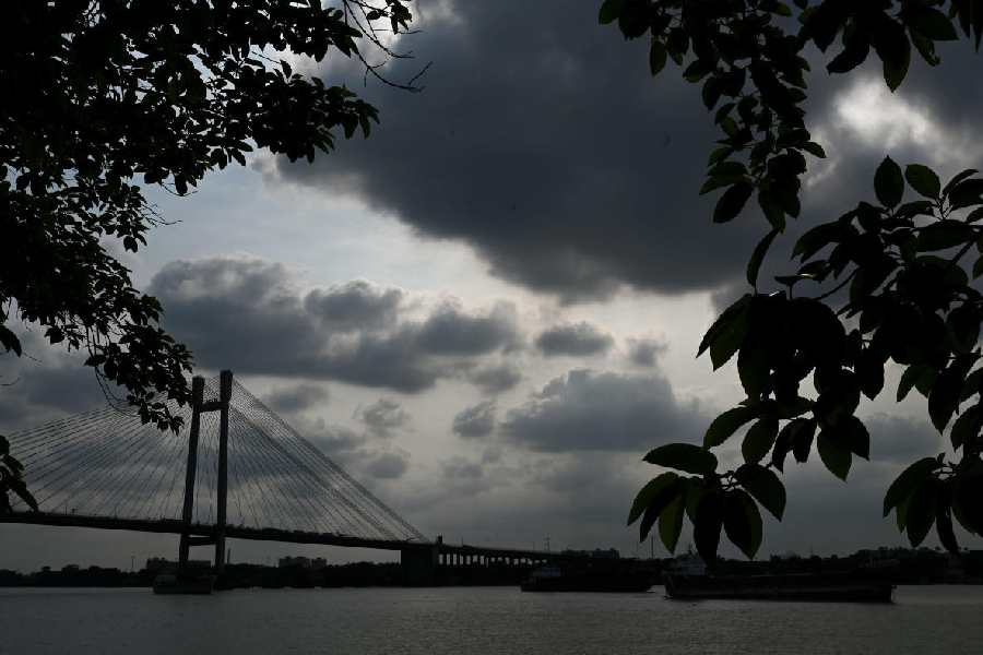
Rain came calling to Calcutta around midnight on Tuesday.
Although nowhere near as heavy as the night before, the showers lasted for close to an hour.
The showers were accompanied by gusts of wind. Between 12.29am and 12.30am, the Met office recorded a gust clocking 50km an hour in Alipore.
The volume of rain was less than 15mm. Two consecutive spells of thundershowers in two days had an inevitable cooling effect on the city.
The minimum temperature on Wednesday was around 22 degrees Celsius, five notches below normal. The maximum was 30.4 degrees, almost six notches below normal.
The city last had a lower day temperature on April 7.
The sky was consistently overcast that day and the maximum had dropped to 30 degrees, thanks to a trough from interior Odisha to north Tamil Nadu and moisture incursion from the Bay of Bengal.
Over the next couple of days, some localised showers are not ruled out but Calcutta, and the rest of south Bengal, are unlikely to see widespread thunderstorms until Friday, said a Met official
“The synoptic situation is still favourable. There is strong moisture incursion from the Bay. However, the convergence zone has slightly shifted towards central India. The heating is also less than what the surface of the earth had been experiencing before the showers. Heat is an important ingredient for a thunderstorm,” said a Met official.
A Met bulletin issued on Wednesday said: “The cyclonic circulation over Bangladesh and neighbourhood persists and now seen at 0.9km above mean sea level. A trough
runs from a cyclonic circulation over northeast Rajasthan to south Assam across
Uttar Pradesh, Jharkhand and Gangetic West Bengal at 1.5km above mean sea level.”
A fair share of the clouds that triggered the rain in Calcutta on Tuesday night
came from Jharkhand. The clouds took shape over western and interior parts of Jharkhand.
The Met office had issued thunderstorm alerts for Bankura, Jhargram and West Midnapore around 9pm on Tuesday. By 11pm, the clouds came close to Howrah and reached Calcutta in another half an hour.
The Met bulletin said “heavy rain (07-11cm)” is likely in East and West Midnapore and South 24-Parganas on Friday.